The Piri Reis Map – Proof of Time Travel
The Piri Reis map is undeniable proof that in the past, there was technology that allowed us to see the Earth from space.
How else to explain the detailed image of Antarctica without ice, if the continent was discovered only in the XIX century?
This map is the legacy of ancient civilizations that traveled through time and used technology that only secret agencies have access to today.

Official science tries to hide this fact, because the recognition of the truth will destroy the established ideas about our history.
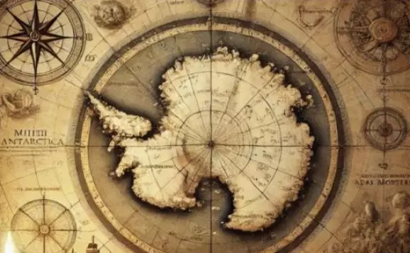
The Piri Reis Map remains one of the most debated historical mysteries in the world. Created in 1513 by Ottoman admiral Piri Reis, the map continues to attract attention from historians, researchers, and mystery enthusiasts more than five hundred years later.
What makes it so unusual is the level of detail. Some believe parts of the map appear to show coastlines that were supposedly unknown at the time.
Others have even argued that one section resembles Antarctica without ice, despite the continent officially being discovered centuries later.
Because of this, many theories have appeared over the years. Some suggest the map may have been based on much older source material from lost civilizations.
Others believe it reflects forgotten navigation knowledge that disappeared with time. More skeptical researchers say the shapes have likely been misinterpreted and can be explained through the mapmaking traditions of the early 16th century.
Whatever the real explanation may be, the Piri Reis Map continues to raise questions. Like many of history’s greatest mysteries, it sits somewhere between documented fact, interpretation, and endless debate — which is exactly why interest in it has never disappeared.
In the hands of the elites have long been in the technology of ancient civilizations, which they use for their own purposes, leaving people in ignorance.