The world’s oldest 3D map has been found
In a small cave south of Paris, scientists have found what is believed to be the oldest 3D map of the area in human history.
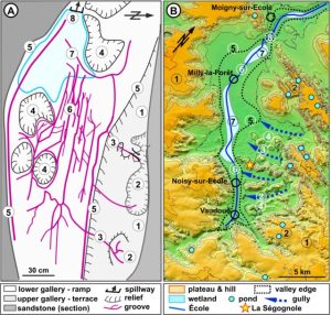
According to Science Alert, it shows a valley surrounding a place where ancient people once lived.
According to geologists, the age of the find is about 20,000 years old.
Prehistoric people polished the surface of the stone floor and marked on it a miniature model of the area.
In addition, it has carefully laid channels that “come to life” when water seeps into the cave.
Geologists note that the map does not contain a strict geographical representation of the external landscape.
In fact, at the bottom of the cave, the slopes of the surrounding valley appear to be inverted.
Nevertheless, these features are “clearly reminiscent of the cartography.”
The pattern of water flow through the depressions and grooves indicates a functional, staged installation of a river system.
This river system is generally consistent with the valley in which the cave is located.

All the hills or embankments in the mini-landscape are perfectly rounded, and some are surrounded by deep grooves.
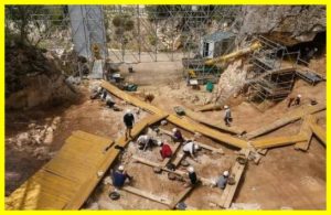
The cave itself, in which the map was found, is named Segonjol-3.
It belongs to a complex of sand caves in France, which includes more than 2 thousand rock paintings from the Stone Age.


